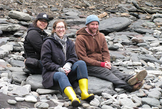
So, there was some informational sign about plate tectonics and stuff that I sort of read . . .
Here's the basics: In Gros Morne National Park there is a place where the Mantle of the earth is exposed. So, if you remember your third grade science, the earth is made up of layers: we live on the crust, below us is the mantle, under that is middle earth (where hobbits and trolls live) and under that is the core. If you dig all the way through, you get to China. Look it up. I used to be a teacher.
When the earth was still one super-continent, the plates parted and then slid over each other, pushing up the mantle onto the sea bed. Years later when the plates separated into different continents the mantle was revealed, looking something like ocher. It is apparently toxic to vegetation (so, if you're a gardener, the mantle is a bad place to buy real estate).
Monday, May 21, 2012
Gros Morne National Park
Friday, May 11, 2012
How to Get to the Bell Island Secret Beach
 |
| Go to Bell Island. You can get there by ferry, or you can swim. Swimming is not advised. |
 |
| When you get there, drive around and look at the sights. Like this cool old farm, or . . . |
 |
| This lighthouse, or . . . |
 |
| random icebergs. |
 |
| Drive around until in the distance you see . . . |
 |
| whatever the hell this is. |
 |
| And these cliffs. Scale the cliffs onto . . . |
 | ||
| This beach where you will find . . . |
 |
| this old mine cave. Go through the cave. You will exit on . . . |
 |
| This awesome beach! |
 |
| Where it's way to frigid to swim, and there is not sand for castles. |
 |
| So, instead build Labradorian stone structures. |
 |
| On your way out, it goes without saying that you should stop at Dick's for fish and chips. |
 |
| And admire the children's art work on the walls. "I loves me Dick's!" |
St. Mary's Miniature Village
So, this is a miniature version of the town of Oderin. Oderin was a small outport fishing town. In the 60's, a premier named Joey Smallwood instituted a program called "resettlement" to move people from towns like this to larger towns where it was easier for the government to provide electricity and other services. People actually moved their houses (towed on rafts behind boats or across the ice). In the town of St. Mary's, a former resident of Oderin recreated a scale model of the town beside the highway. Pretty cool.


 | |
| Outhouse | This one is sideways, but it's also a little profane, so it all works out |
 |
| Abandoned bridge on the way out of town. |
Tuesday, April 17, 2012
More Icebergs
Daring duo climb iceberg near St. John's
http://www.cbc.ca/news/canada/newfoundland-labrador/story/2012/04/18/nl-iceberg-climbers-419.html?cmp=rssThis pair of icebergs parked themselves in Quidi Vidi, a small town on the edge of St. John's, on April 16th.
http://www.cbc.ca/news/canada/newfoundland-labrador/story/2012/04/18/nl-iceberg-climbers-419.html?cmp=rssThis pair of icebergs parked themselves in Quidi Vidi, a small town on the edge of St. John's, on April 16th.
 |
| View from Signal Hill (in St. John's) on April 15th (100 years after the Titanic sank 365 miles away). |
Tuesday, April 10, 2012
Cape Race
On the foggiest day yet, I took a trip with some friends to Cape Race to see the lighthouse where the Titanic's distress call was received, and then drove the Irish Loop (the yellow line on the map below. This is the Avalon Peninsula--I live in St. John's--that hangs off of the southeast coast of Newfoundland.) Here are some shots from the trip:
 |
| Bog around the Cape Race lighthouse |
 |
| Cape Race Lighthouse |
 |
| Trepassey Lighthouse |
 |
| Old walls built for farming |
 |
| Moya making friends |
Subscribe to:
Comments (Atom)


